
Monumental 3D mapping turns the surface of a building, a facade or a landmark into a giant animated screen, blending high-brightness video projection with graphic content engineered precisely around the architecture. Producing a large-scale show like this requires a chain of expertise that goes well beyond simply playing back images: site survey, heritage permits, 3D modelling, lighting and sound design, high-level equipment installation, night calibration.
This article walks you through every stage of producing a monumental mapping show, from feasibility to live exploitation. It complements our overview article on 3D mapping: guide, technology and applications, which covers the conceptual foundations.
What is monumental 3D mapping?
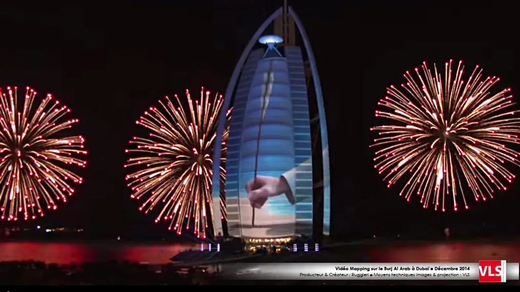
Monumental 3D mapping is a large-format video projection technique in which content is precisely fitted to the surface of a building, following its volumes, reliefs and openings to create the illusion of a total visual transformation. Unlike flat projection, every pixel of the image is geometrically corrected to match the real architecture of the support, whether a Gothic cathedral, a town hall, a contemporary tower or a festival scenography structure. The result is an immersive show visible from a public square, requiring no special equipment on the audience side.
The term covers several realities depending on scale: building projection or facade projection for a single elevation, 3D mapping when depth illusion is pushed to the foreground, and monumental mapping or large format when the projected surface exceeds several hundred square metres. For a discussion of terminology differences, see our article on video mapping vs 3D mapping.
Which buildings and surfaces are suitable?
The choice of projection surface is one of the first structural decisions in a monumental mapping project, since it determines both technical feasibility and the administrative approach.
Flat and geometric facades
Predominantly flat facades (town halls, conference centres, 20th and 21st-century museums) offer the best projection conditions: geometric correction is limited, apparent brightness is optimal and the required throw distance remains manageable. They lend themselves to typographic animations, explosion or immersion effects and complex narrative staging.
Relief-heavy structures: cathedrals and listed monuments
Buildings with pronounced relief (cathedrals, chateaux, viaducts, arches) require thorough 3D modelling and precise zone mapping to exploit the recesses and projections. Listed or registered heritage buildings also require specific permits from heritage authorities. Heritage constraints may prohibit attaching any equipment directly to the building fabric.
Temporary structures and festival scenographies
For festivals or inauguration events, it is sometimes preferable to build a dedicated projection surface: stretched screen, inflatable structure, aluminium-framed scenic facade. These surfaces offer complete creative freedom and simplify administrative procedures, but add additional rigging logistics.
LED walls and hybrid solutions
In some cases, projection is combined with or replaced by flexible or semi-rigid LED walls mounted on the facade. This option is relevant when throw distance is insufficient or when the site is too brightly lit. VLS integrates this expertise within its large image offering.
Steps in a monumental mapping production
Producing a monumental mapping show means orchestrating a sequence of interdependent stages. Overlooking or underestimating any one of them inevitably affects those that follow.
1. Feasibility and technical site survey
First of all, a site survey is essential. This means measuring the usable surface area of the facade, checking throw distances available for the projectors, assessing ambient light pollution (street lighting, signage) and mapping potential obstructions (trees, street furniture, cables). Surface reflectance is also checked: a dark wall absorbs light and requires compensating with more powerful projectors. A night survey is always recommended to measure actual conditions.
2. Permits: heritage, highway and safety authorisations
Projecting onto a public building or a protected site requires several parallel steps:
- Heritage authorisation: if the building is a listed monument or located in a protected perimeter, a request must be submitted to the relevant heritage authority, sometimes months in advance.
- Highway permit: deploying cables, parking production vehicles and installing safety barriers require a municipal or prefectoral order.
- Safety plan: for a public-facing event, a safety scheme (crowd management plan, emergency exits, safety perimeter around projectors) is required, and may be reviewed by a safety commission.
- Copyright and music rights: if the soundtrack or visuals include protected works, the relevant declarations are mandatory.
3. 3D modelling of the facade
3D modelling is the step that determines the final precision of the mapping. It involves creating an accurate digital model of the building, capturing every relief, every window, every architectural ornament. Methods range from laser survey (LiDAR scan) to drone photogrammetry and manual surveys using a total station. This model is the reference used by the warping and blending software to ensure each projector sends exactly the right portion of the image to exactly the right location.
4. Artistic direction and content creation
Content for a monumental mapping show is created against the 3D model: the artistic director and motion designers work in a virtual environment that faithfully replicates the facade. Animations are composed layer by layer, accounting for constraints around black levels (dark areas vanish into the real surface), transitions between projected and unprojected zones, and overall narrative staging. For a sound-and-light show, the musical composition and any pyrotechnic or laser effects are synchronised at this stage.
5. Projector placement plan
The placement plan determines the number of projectors, their type (lumen output, resolution, optics), their exact position and angle. This calculation accounts for the surface area to cover, the required lumen level (in lux on the facade), the overlap needed between projectors for blending, and the physical constraints of the site (available positions, power supply, access). For a large facade, projectors are arranged in a grid and their images overlap with a blend to achieve perfect uniformity.
6. Installation and technical cabling
The installation phase involves technicians qualified for work at height to mount projectors on load-bearing structures, facades or stage towers. Data cabling (fibre optic or video signal) and electrical cabling (distribution panels, generators if needed) are carried out in parallel. This phase is planned by day but tested at night.
7. Night calibration and rehearsals
Calibration is the most delicate phase and often the one most underestimated in terms of time. It involves aligning each projector to the 3D reference model via the warping software, setting exposure levels, harmonising colours across projectors and synchronising playback with the soundtrack. Several calibration nights are typically needed for a large-scale project. Full dress rehearsals validate the complete show before opening night.
8. Exploitation and show nights
During exploitation, a technical crew handles playback, monitors equipment and responds to any incident (stray projection, projector failure, audio/video sync issues). A contingency plan is prepared for each critical point. At the end of the run, decommissioning follows the same safety constraints as installation.
Large-format constraints
Monumental mapping projects concentrate constraints that barely exist at smaller scale. The table below summarises them with their implications and the solutions commonly employed.
| Constraint | Implication | Solution |
|---|---|---|
| Urban light pollution | Loss of contrast and legibility for dark content | High-brightness projectors (20,000+ lumens), temporary dimming of public lighting agreed with local authorities |
| Insufficient throw distance | Unable to cover the entire facade with a single projector | Multi-projector setup with blending, or LED wall alternative |
| Wind and adverse weather | Stability of load-bearing structures and exposed cabling | Wind load calculations, certified fixings, high IP-rated protective covers for equipment |
| Restricted facade access | Cannot attach equipment to a listed heritage building | Ground-based self-supporting structures, stage towers, repositioned aerial platforms each evening |
| Surface heterogeneity | Reflectance differences between stone, glass and metal | Zone-by-zone colour correction per material during calibration |
| Power supply | High power draw at a site that may lack adequate connections | Remote generators, mains connection via construction supply in coordination with the grid operator |
| Crowd management | Public safety around projectors and cabling | Marked safety perimeter, sheathed cables with approved cable ramps, coordination with event security |
Delivering a successful sound-and-light show
A sound-and-light show is the most fully developed narrative form of monumental mapping: it pairs an original soundtrack, typically musical or spoken, with facade projection, sometimes enhanced by pyrotechnics, lasers or haze effects. Delivering this type of show depends on coherence across four dimensions.
Narrative. A son et lumiere tells a story connected to the building, the city or the commissioning event. The script must be developed from the outset: it determines the show duration, the pacing of sequences, key visual moments and breathing spaces. Close collaboration between the artistic director, the composer and the technical provider ensures the creative vision is achievable under real site conditions.
Audio/video synchronisation. The soundtrack generally drives everything: synchronisation points are encoded in a timecode signal (LTC or MTC) that triggers visual sequences. Even a few frames of drift is immediately noticeable at large format. Latency tests between audio output and video output are carried out from the first calibration nights.
Technical redundancy. For a live event in front of thousands of spectators, every critical link has a backup system: standby video server, replacement projector on site, backed-up power supply. A fault management plan is issued to the technical crew before opening night.
Integration with the sonic environment. In an open urban space, sound diffusion has specific constraints: delays between speaker lines to compensate for propagation across the space, sound level management at property boundaries (prefectoral order on nocturnal noise), loudspeaker orientation to cover the audience zone without spilling beyond it. These parameters are calculated and simulated in advance with acoustic spatialisation software.
VLS and monumental projection
VLS has been supporting local authorities, event agencies and festival organisers in producing monumental mapping shows since the discipline's earliest days in France. A technical audiovisual provider founded in 1983, VLS brings integrated expertise covering feasibility consulting, 3D modelling, selection and supply of large-format projection equipment, lighting and sound engineering, on-site technical direction and coordination of all permit phases.
Our team handles both one-off events (inaugurations, festivals, official ceremonies) and recurring shows with extended exploitation runs. Every project receives a field survey, a custom technical file and end-to-end follow-through. Explore our work in the productions section and our large image expertise page.
Ready to assess the feasibility of your monumental mapping project? Contact our team for an initial technical discussion.
FAQ: monumental 3D mapping and building projection
What is the difference between monumental mapping and architectural projection?
Architectural projection is a general term for any video projection onto a building or built structure. Monumental mapping is its large-format application, used for surfaces ranging from several hundred to several thousand square metres, with precise geometric correction and high brightness levels. See our article on 3D mapping: guide, technology and applications for the fundamentals.
What permits are needed to project onto a listed heritage building?
As a general rule, authorisation is required from the relevant regional heritage authority and, where applicable, from the heritage architect responsible for the building. These procedures can take several weeks to several months. It is essential to plan ahead and put together a complete technical file (placement plan, nature of fixings, content description) to support the review process.
How many projectors are needed for a monumental mapping show?
The number of projectors depends on the surface area to cover, the available throw distance and the target brightness level. For a mid-size facade (500 to 1,000 m2), the typical range is 4 to 12 high-brightness projectors. For very large surfaces or multi-facade configurations, the count can exceed twenty. Each project receives a dedicated lumen calculation.
How long does the calibration phase take?
For a large-scale monumental mapping project, allow 2 to 5 calibration nights, depending on the complexity of the facade, the number of projectors and the richness of the content. This phase must not be underestimated: poor calibration is immediately visible in the final show quality.
Can a monumental mapping show run in strong wind or rain?
Light to moderate rain does not prevent projection (equipment is weather-protected), though it can affect visual quality if droplets create diffusion in the light beam. Strong wind is the primary constraint for load-bearing structures and cabling. A wind resistance plan is established at the design stage of the placement plan.
Is monumental mapping possible on a glass facade?
A fully glazed facade is poorly suited to projection, as glass reflects light specularly and transmits part of the flux into the building interior. However, mixed facades (stone and glass) or treated glazing can be handled with adapted colour correction. A surface reflectance analysis is essential during the site survey.
What is the minimum duration for a sound-and-light show?
A sound-and-light show typically runs between 8 and 25 minutes per performance. Below 8 minutes, it is difficult to develop a satisfying narrative arc. Beyond 20 to 25 minutes, audience attention in an open-air setting tends to wane. Optimal duration depends on the event context and the number of performances per night.
What is the difference between 3D mapping and video mapping?
Both terms refer to the same underlying technique, with differences in emphasis. Video mapping foregrounds the video and narrative dimension of the content, while 3D mapping highlights the depth illusion and geometric modelling. In both cases, the projection is corrected to fit the physical surface. For more detail, read our article on video mapping vs 3D mapping.
Read also: 3D mapping: guide, technology and applications | Video mapping vs 3D mapping | VLS productions
